
WMO Strategic Priority: WIGOS and WIS, Polar and High Mountain Regions, Capacity Development
Status: Ongoing
Funding: Contributions by participating countries
Programmes: Hydrology and Water Resources Programme
Implementation in: Canada, Denmark, Finland, Iceland, Norway, Russian Federation, Sweden, USA
Regions: Region IV: North America, Central America, Caribbean; Region VI: Europe
Donors: Contributions by participating countries
Project Partners: WMO
The Arctic-HYCOS project aims to collect and share hydrological data and information for the Arctic basin to enable better climate research and predictions in the Northern Hemisphere. The project serves as a vital platform for the regular collection and free exchange of Arctic hydrological data from all participating nations. The available real-time and historical data is intended to allow researchers to:
- evaluate freshwater flux to the Arctic Ocean & Seas,
- monitor changes and enhance understanding of the hydrological regime of the Arctic region, and
- estimate flows in ungauged regions and develop models for enhanced hydrological prediction in the Arctic.
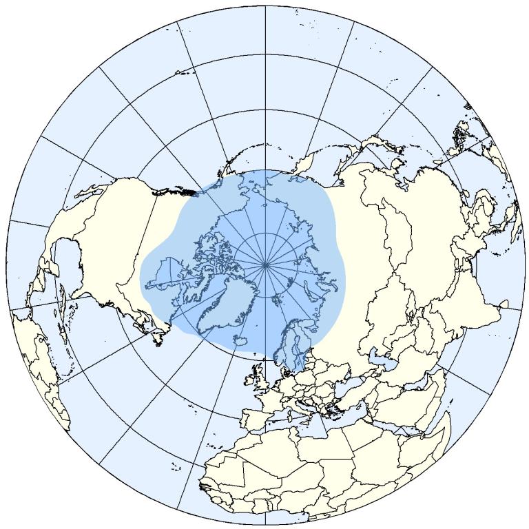
- R Water ML Library (via WHOS) for information on data download scripts
Reports
- Arctic-HYCOS Project Implementation Plan, March 2014.
Project Steering Committee Meeting Minutes
- Third Arctic-HYCOS Project Steering Committee Meeting, 24-26 May 2016, Anchorage, Alaska;
- Second Arctic-HYCOS Projects Steering Committee Meeting, 23-24 March 2015, Reykjavik, Iceland;
- Arctic-HYCOS Planning and Implementation Meeting, 26-27 March 2014, Geneva, Switzerland
- E-monitoring the nature of Water, Silvano Pecora & Harry F. Lins, February 2020
- Analysis of Trends in Annual Streamflow to the Arctic Ocean, Martin Durocher , Ana Requena, Donald H. Burn, Jennifer Pellerin, 2019 (post-print version - published version can be purchased here)
- Arctic-HYDRA, The Arctic Hydrological Cycle Monitoring, Modelling and Assessment Programme, 2010
- Freshwater Ice and Water Temperature: Manuals, Standard Practices and Standard Operating Procedures – Annotated Bibliography
- Freshwater Ice and Water Temperature: Manuals, Standard Practices and Standard Operating Procedures – Summary
The definitions below relate to attributes of the Arctic-HYCOS data and information for each station.
Basic Network of Hydrological Stations |
The Arctic-HYCOS Basic Network of Hydrological Stations (BNHS) station list was created from a selection of existing stations from the national hydrological networks in the Arctic basin. There are two sub-networks - Network A is all stations in the Arctic-HYCOS database, and Network B includes only those stations that represent flow-to-ocean. Hydrological Regime (Network A) Stations suited to study changes in the Arctic hydrological regime (covering the entire land mass draining into the Arctic Ocean and northern seas).
Flow-to-ocean (Network B) Stations that are the most downstream monitoring stations on rivers flowing to the Arctic Ocean and northern seas. These stations can be used to estimate total freshwater Flux to the Arctic.
|
||||||||||||||||
Drainage area |
The drainage area of a basin or catchment representing the area of land upstream from the hydrometric gauge where topography causes falling precipitation to collect in the same creeks, streams, rivers, lakes, and reservoirs, the outflow for which is at the gauge location. The Arctic-HYCOS database includes the gross drainage area and the effective drainage area for each gauge, in km2 . The Drainage_shapefile variable indicates whether a vector shapefile for the total drainage area corresponding to the hydrometric station is available (1) or not (0) from the operating country/institute.
|
||||||||||||||||
Regulation |
This attribute is intended to identify whether the basins represented by hydrometric stations have “significant” regulation or diversions in the upstream river system. This designation reflects only the physical structures within the waterways upstream of the site; it does not reflect the land use within the basin. Regulated (1): Basins with structures providing significant flow regulation, based on the host country’s standards. The definition for “significant regulation” may vary by country, as defined in the metadata field “regulation_definition”. If no standard is available, “regulated” is defined as basins with structures controlling more than 5% of the basin area. No Significant Regulation (0): If there are no significant regulation structures upstream from the station, or diversions within the river system, based on the country’s definition. This generally represents “natural” flow conditions, but not necessarily “pristine” basin conditions.
|
||||||||||||||||
Land Use Change |
Significant land use changes that result in changes to the flow regime. A “significant” amount of land use change in a basin is defined as a modification of over 10% of the surface area of the station’s drainage area (Environment Canada, 1999). Land use change: 0: if there is no significant change. |
Project Steering Committee Chair and Member
Canada |
Chair: Meteorological Service of Canada, Environment and Climate Change Canada National Hydrology Research Centre Project Steering Committee Secretariat Ms Gillian Walker National Hydrological Services, Environment and Climate Change Canada
|
Finland |
Dr. Johanna Korhonen Finnish Environment Institute (SYKE)
|
Iceland |
Dr. Jorunn Hardardó Icelandic Meteorological Office
|
Norway |
Dr. Hege Hisdal Norwegian Water Resources and Energy Directorate (NVE)
|
Russian Federation |
Prof. Valery Vuglinsky State Hydrological Institute of Roshydromet
|
Sweden |
Dr. David Gustafsson Swedish Meteorological and Hydrological Institute (SMHI)
|
United States of America |
Mr. Jeff Conaway U.S. Geological Survey (USGS)
|
Global Runoff Data Centre |
Mr. Ulrich Looser Global Runoff Data Centre (GRDC) |